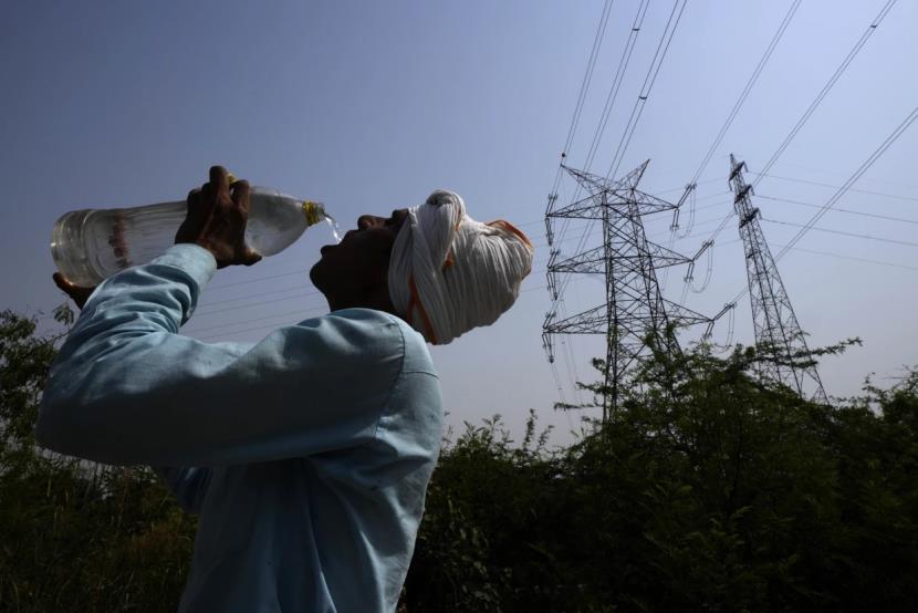
NEW DELHI: The Director-General of Meteorology at the India Meteorological Department (IMD) Mrutyunjay Mohapatra said on Thursday that a fresh spell of heatwave is likely to commence in some parts of northwest India and central India.
“Due to the presence of western disturbance over Northwest India, the heatwave has abated in the past 2-3 days, while the day temperature has fallen and this condition is likely to continue for the next two days. However, a fresh heatwave spell is likely to commence in Rajasthan. Isolated heatwave conditions are expected to start in Rajasthan, Madhya Pradesh, and Vidarbha especially. For Rajasthan, it will be for today and tomorrow (May 5 and May 6), and on May 7, it (heatwave) will spread into some other parts of northwest India and central India,” Mohapatra said.
A heatwave warning will be issued for isolated places of Rajasthan, Madhya Pradesh and the Vidarbha area, soon. “The heatwave condition is likely to spread to some more parts of northwest and central India after May 7,” he said.
Observing the weather patterns in South India, the IMD Andhra Pradesh has issued several guidelines for the weather for the next five days.
According to the IMD, the North Coastal Andhra Pradesh (NCAP) and Yanam in Andhra Pradesh are likely to experience thunderstorms with lightning, while the South Coastal Andhra Pradesh (SCAP) and Rayalaseema of Andhra Pradesh can witness a thunderstorm accompanied by lightning and gusty winds with a speed of 40-50 km per hour today (Thursday).
The IMD predicted that places in NCAP and Yanam, SCAP and Rayalaseema can face thunderstorms with lightning and gusty wind with 30-40 km per hour speed on Friday.
One or two places in Rayalaseema can witness thunderstorms with gusty winds of 30-40 km per hour on Saturday.
The places in NCAP and Yanam, SCAP and Rayalaseema are expected to face thunderstorm accompanied by lightning on Sunday as well as Monday.
“Trough/wind discontinuity from Vidarbha to south Tamilnadu now runs from above cyclonic circulation over northwest Madhya Pradesh to Comorin area across Vidarbha in Maharashtra, Telangana, Rayalaseema in Andhra Pradesh, and the interior Tamil Nadu at 0.9 km above mean sea level,” said the IMD.
“The cyclonic circulation over South Andaman Sea and its neighbourhood extending upto mid tropospheric levels persists. Under its influence, a Low Pressure Area is likely to form over the same region on May 6. It is very likely to move northwestwards and intensify gradually into a depression during subsequent 48 hours,” it said further.
Talking about weather conditions in eastern India, Mohapatra said, “Currently, in Eastern India, there is an active thunderstorm activity and hence the temperature will be near normal. There are no heatwave conditions. Similar is the case with respect to northeastern states and the southern peninsula region.”
He further said, “Apart from that, cyclone circulation lies over the Andaman sea. On its influence, a low-pressure area is likely to form on May 6, over the South Andaman Sea and areas adjoining the southeast Bay of Bengal. It is likely to move northwest across the Andaman Islands and the depression over the southeast Bay of Bengal will be intensified by May 8.”
“We have issued a warning, especially for the fishermen, to not venture into the Andaman Sea and the areas adjoining the southeast and the east-central Bay of Bengal because of the adjusting cyclone separation and expected depression over the area,” he added further.
Currently, no warning has been issued in association with this expected depression by the IMD for the mainland, but there are thunderstorm warnings for eastern states, northeastern states, and some parts of the southern peninsula.
